Unfortunately we do not possess many old maps of Colton. However we do have one from 1882 that is beautifully coloured and provides us with a wealth of information about Victorian Colton. What is apparent from the maps we have is how little changed Colton is!
We intend to add more maps to this site at a later date.
We have prepared a leaflet as a self guided walk through Colton village which can be printed out.
| 1882 Estate Map of Colton Victorian map showing the whole of the village. 1882 Estate Map of Bellamour Victorian map showing the whole of the village. | 1882 Map of Colton Village Centre Pinpoints the buildings of Distinction. |
1882 Map of Colton Village
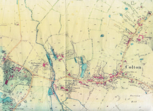 This map shows the Bellamour Hall houses and gardens on the left and the main road running through the village. The main road at that time was called Brook Street up to the fork. At this point it turned left into High Street and right into Hollow Lane. |
1882 Estate Map of Bellamour House
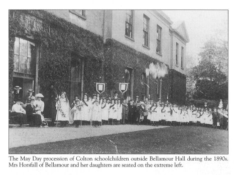 | The main manor house of Colton from the mid 17th. century onwards was at Bellamour. There were in fact two houses built on this site- the first by Herbert Aston in the 1640’s and the second by Mary Blount for her son in the second half of the 18th, Century. The picture above shows this second house when it was in the ownership of the Horsfall family. |
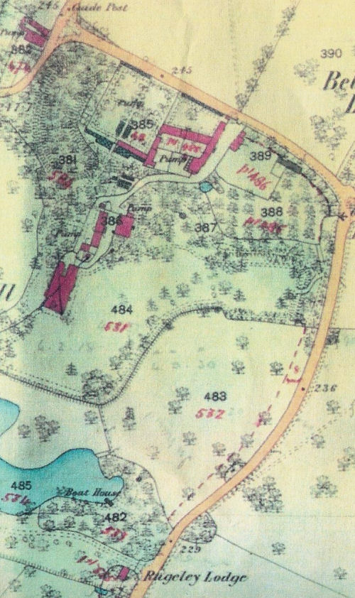
The gardens were supposed to be some of the finest in Staffordshire.
1882 Map of Colton Village Centre
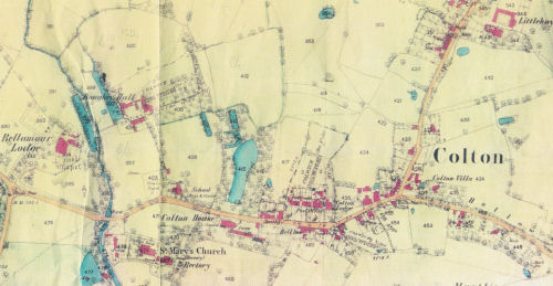 | This map shows the central part of Colton village. Clearly visible are the positions of Bellamour Lodge, St. Mary’s Church, St Mary’s School, Boughey Hall Farm, The Old Rectory, Colton House, The Malt House and Little Hay Manor. We welcome any further information you may have about these buildings and the village. |